Hurricane Karina Spurs Potentially Dangerous Surf Conditions
Hurricane Karina Intensifies in the Pacific
Hurricane Karina has become a formidable Category 4 storm in the eastern Pacific. The storm is producing swells that might reach Southern California, posing risks of dangerous surf and rip currents. According to NOAA’s National Hurricane Center (NHC), these swells will impact parts of southwest Mexico and the Baja California Peninsula for several days, potentially moving toward Southern California from Monday through midweek. “These swells are likely to cause life-threatening surf and rip current conditions.”
Karina’s Trajectory
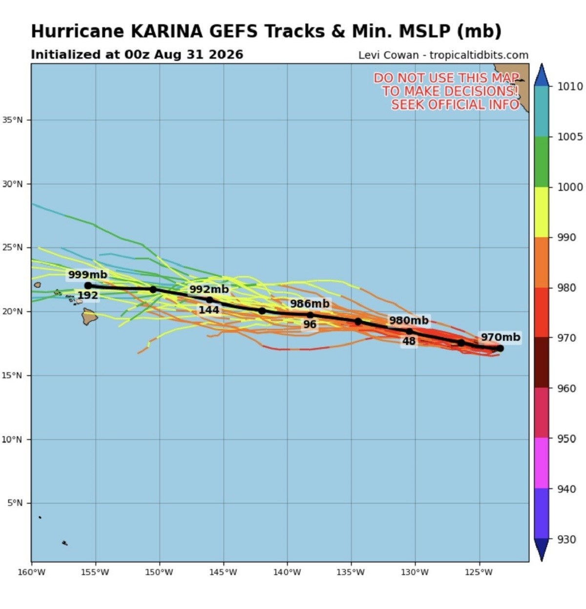
Karina is not expected to pass directly over California. The hurricane is moving westward, deeper into the Pacific. Currently, Karina is approximately 1,020 miles (1,640 kilometers) west-southwest of Baja California’s southern tip. It has maximum sustained winds reaching 145 mph, continuing west at 9 mph. No coastal watches or warnings are in place.
Spaghetti-Model Guidance and Forecasts
The latest spaghetti-model guidance available on Tropical Tidbits suggests that Karina will maintain a generally westward path over the open Pacific, avoiding direct landfall in Mexico and California. These models display potential storm tracks using acronyms like GEFS (Global Ensemble Forecast System), illustrating varying possible paths. MSLP (minimum mean sea level pressure) and mb (millibars) are crucial in forecasting, with lower MSLP indicating a stronger storm.
Surf Conditions Warning and Advisory
Karina is projected to move west on Monday, shifting west-northwest on Tuesday. The NHC’s latest forecast anticipates the hurricane will remain over the Pacific for the coming weeks. The agency warns about swells affecting southwest Mexico and the Baja California Peninsula shortly, with conditions likely extending northward to Southern California soon after.
The NHC underscores the expected creation of life-threatening surf and rip-current conditions.
Monitoring Hurricane Karina and Local Advice
Karina currently stands near 17.2 degrees north latitude and 124.4 degrees west longitude, moving west at around 8 knots, with peak sustained winds of 125 knots and gusts up to 150 knots. Additional strengthening might occur, followed by potential intensity changes midweek. The forecast suggests Karina will continue further into the Pacific.
Beachgoers in Southern California should remain informed by consulting local weather reports and heeding advice about surf and rip-current threats as swells intensify. The NHC has specifically advised residents to refer to local weather-office guidance for detailed information.