Google Earth Images Reveal Extensive Destruction in Gaza
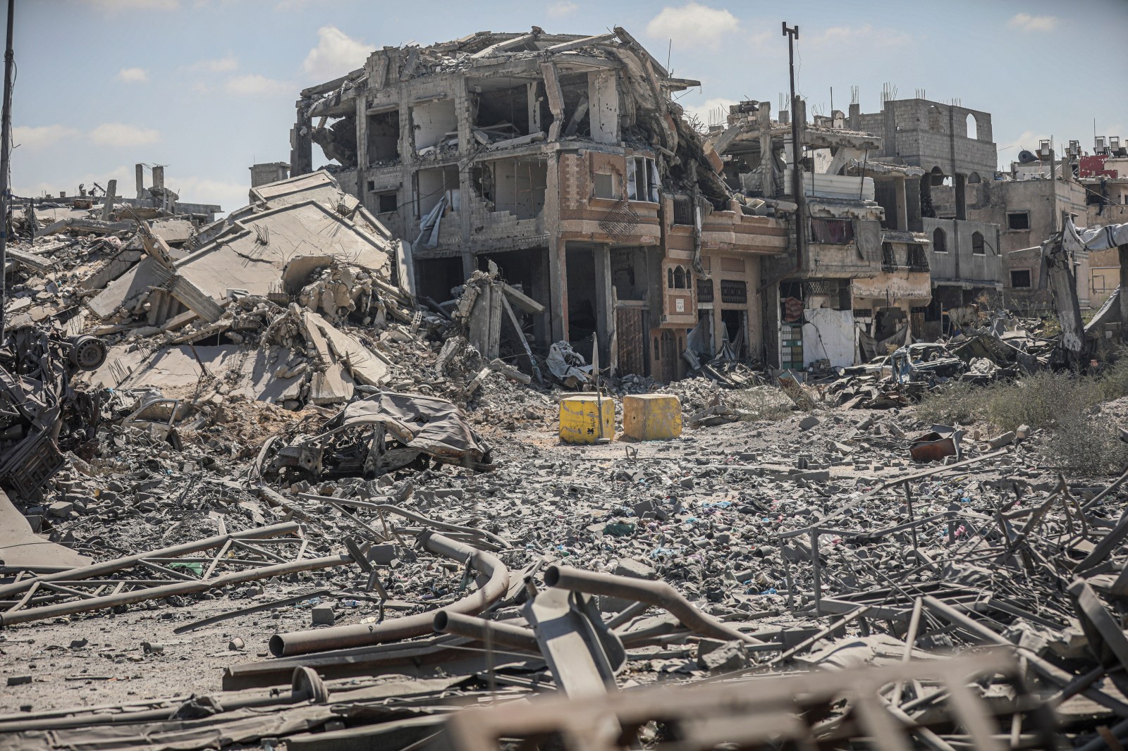
Recent Google Earth images displaying the devastation in Gaza from the ongoing conflict between Israel and Hamas have garnered widespread reaction from social media users and experts. Satellite images shared online illustrate the aftermath of Israeli military responses following Hamas’ assaults on southern Israel on October 7, 2023. Although Google Earth has not specified the upload date, reports suggest some imagery was captured throughout the year. Newsweek reached out to the Israeli military and Google Earth for comments.
Impact of Google Earth Imagery
Barry Andrews, an Irish Member of the European Parliament, shared his reaction on X, highlighting the visible destruction, with flattened buildings and districts in ruins. His post received significant engagement, indicating public interest and concern.
“The updated Google satellite images of Gaza are quite incredible, for all to see,” he wrote. As of Monday afternoon, it had gathered five million views, 30,000 likes, and thousands of reposts.
Chris Doyle, director of the Council for Arab-British Understanding, emphasized the imagery’s role in documenting the extensive damage. Doyle noted that 82% of Gaza’s buildings have suffered destruction or damage. He underscored the long-term shock value of these images and speculated on their potential influence on global political leaders, including those in the U.S.
“These images have shocked the world for years. The question is when they will shift the positions of major leaders,” he stated.
Nathan Ruser, an analyst at the Australian Strategic Policy Institute, remarked on X about the startling detail of Gaza’s imagery.
What the Images Reveal
The October 7 attacks by Hamas resulted in the deaths of at least 1,200 people and the kidnapping of over 250 individuals. In response, the Israeli military actions have led to the death of 74,016 Palestinians, with 175,068 wounded as of Monday, according to the Associated Press and Gaza’s Health Ministry.
Although a ceasefire began on October 10, 2025, Israeli strikes continue as responses to perceived threats. UNOSAT reported on August 12 that approximately 82% of structures in Gaza, totaling 200,000, had been affected, with two-thirds destroyed. This aligns with the new Google Earth images showing extensive destruction.
The southern city of Rafah is notably depicted with areas cleared of buildings and temporary shelters scattered across the landscape. In Gaza City, the imagery around Al Shifa Hospital reveals considerable devastation, contrasting starkly with previous images. The hospital endured severe assaults during the conflict. Israel claimed Hamas operated a command post within the hospital grounds, allegations denied by Hamas and hospital staff.
Context and Challenges
Rebecca Wolfe, a conflict and humanitarian response expert from the University of Chicago’s Harris School of Public Policy, commented on the challenging operational environment during the conflict in Gaza, which is both small and densely populated.
“Targets were often close to critical infrastructure and civilians,” Wolfe said.
She noted the awareness of the risks associated with using powerful weapons in densely populated areas and suggested alternatives could have been considered when targeting Hamas militants.
A United Nations report last week noted that around 1.9 million people in Gaza have been displaced, with many forced to relocate multiple times. Over 60% of the population lost their homes during the conflict, exacerbating the humanitarian crisis.