Severe Midwest Flooding Sparks Emergency Response and Highlights Insurance Gaps
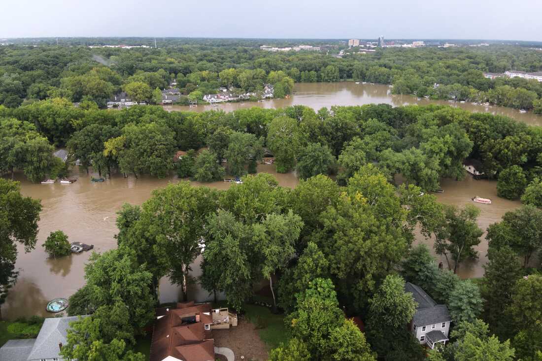
Aerial images from Indianapolis show widespread flooding in northern Indianapolis, Indiana. Ongoing thunderstorms have triggered severe flooding across the Midwest. The National Weather Service forecasts more heavy rain through Sunday across the Ohio Valley, Midwest, and central Appalachians, affecting regions already struggling with rising waters.
The storms have already claimed three lives, and as of Saturday afternoon, over 150,000 individuals were without electricity. Indiana and Ohio are experiencing significant rainfall, exceeding 11 inches in some regions over the past week.
Record-Breaking Flooding and Emergency Measures
The White River in Anderson, Indiana, reached an unprecedented height of 24.9 feet, breaking a record set in 1913. Central Illinois and central Indiana face flash flood and flood warnings, with flood watches extending from Iowa and Missouri to central West Virginia.
“I will do everything in my power to protect Hoosier lives and livelihoods,” declared Indiana Gov. Mike Braun.
Governor Braun has sought a federal emergency declaration for access to federal resources. State resources have been mobilized, a Statewide Disaster Emergency declared, and the Indiana National Guard deployed.
Impact on Local Communities
In addition to continuous rain, Indiana has encountered tornadoes and a derecho. Cyndee Gillmore of Cornerstone Campground in New Castle describes five feet of water inundating essential facilities.
“I’m standing in my house right now and it smells… but we’re going to keep our focus on God,” Gillmore shared.
Despite community support, Gillmore worries about recovery due to the lack of flood insurance, which many affected homeowners also lack. Without such insurance, financial recovery seems uncertain.
Insurance Coverage Gaps
Flood insurance coverage is mainly federally managed by FEMA. Their maps typically focus on coastal storm surges and ignore rainfall and flash flooding. First Street, a risk modeling company, found that more dwellings are flood-prone than FEMA’s maps suggest.
Many homes in disaster zones lie outside FEMA’s designated floodplains, resulting in no flood insurance. An example was Hurricane Helene in 2024, where 98% of impacted homes in North Carolina were outside FEMA’s defined risk areas.
Rising Flood Risks
The National Oceanic and Atmospheric Administration predicts minor to severe flooding. Recent measurements show nearly 10 inches of rainfall in Washington Municipal Airport, Iowa, almost 8 inches in Glouster, Ohio, and over 6 inches in Elkhorn Creek, Kentucky.
This ongoing rainfall feeds into waterways, escalating flood risks downstream, especially with more storms looming in the forecast.