NHC Monitors Potential Tropical Development Across Oceans
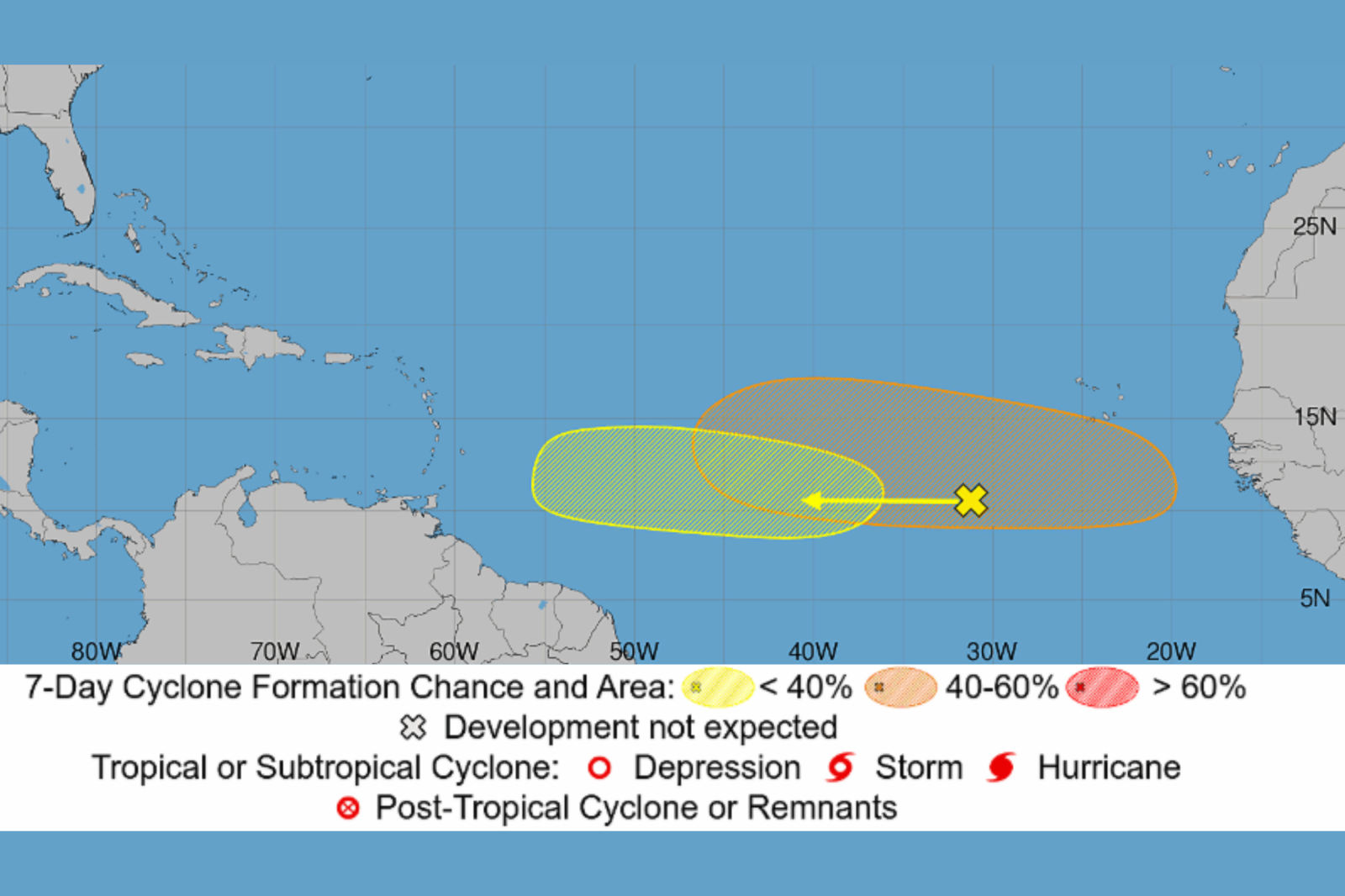
The National Hurricane Center (NHC) is currently observing five regions for potential tropical development in the Atlantic and Pacific oceans. This includes two tropical waves in the Atlantic basin that could potentially evolve into tropical depressions later in the week as the 2026 hurricane season gains momentum.
At present, there are no active tropical cyclones in either basin. However, forecasters are vigilantly monitoring a cluster of disturbances that extend from the coast of Africa to the waters east of Hawaii. The NHC has indicated that the most likely Atlantic disturbance has a 40 percent chance of developing over the next week.
Two Atlantic Systems Under Watch
The NHC’s Atlantic Tropical Weather Outlook highlights a broad area of showers and thunderstorms linked to a tropical wave situated several hundred miles southwest of the Cape Verde Islands off Africa’s west coast. This system is progressing westward across the central tropical Atlantic and may gradually develop in the early to mid-week. Despite this, upper-level winds—swift air currents in the upper atmosphere—are predicted to become less conducive later in the week as the disturbance nears the Lesser Antilles. Presently, the system has almost no chance of formation in the next 48 hours, increasing to 20 percent over the next seven days.
Another tropical wave is expected to depart from Africa’s west coast early this week. Conditions are forecasted to be more supportive for development, and according to NHC, a tropical depression might form in the latter part of the week as it moves westward across the eastern and central Atlantic. This disturbance currently has a 40 percent chance of developing over the next week.
Three Additional Pacific Threats
The Eastern Pacific outlook reveals three additional areas being monitored for development. The most notable is a tropical wave situated over 1,000 miles east-southeast of Hawaii, producing a sprawling area of disorganized showers and thunderstorms. NHC anticipates a tropical depression to develop in a few days as the system travels west-northwestward across the Central Pacific, with its development chances set at 90 percent for the next week.
Another disturbance located southwest of the Baja California Peninsula has a 50 percent formation chance in the next seven days. Meanwhile, a third low-pressure area forecast to develop off Mexico’s southwestern coast has only a 10 percent chance of development.
Potential Land Impact
The Atlantic systems are still far from the open ocean, and the Pacific disturbances are projected to continue moving westward or west-northwestward over open waters. Because these systems have not developed a well-defined circulation, forecasts regarding their exact path and intensity remain uncertain.
Importance of Monitoring
The increase in tropical disturbances indicates a transition into a more active phase for the Atlantic hurricane season. Historically, August marks an uptick in tropical activity, peaking in early September. Although none of the current systems present an immediate threat to the U.S., meteorologists keep a vigilant eye on tropical waves from Africa as they can evolve into tropical storms and hurricanes heading westward across the Atlantic. Currently, the tropical wave expected to exit Africa this week and the Central Pacific disturbance east-southeast of Hawaii are the most likely to become tropical depressions next.
For further details, contact Newsweek editors Matthew Robinson and Robert Greenall.