Flash Flooding Threatens Gulf Coast and Lower Mississippi Valley
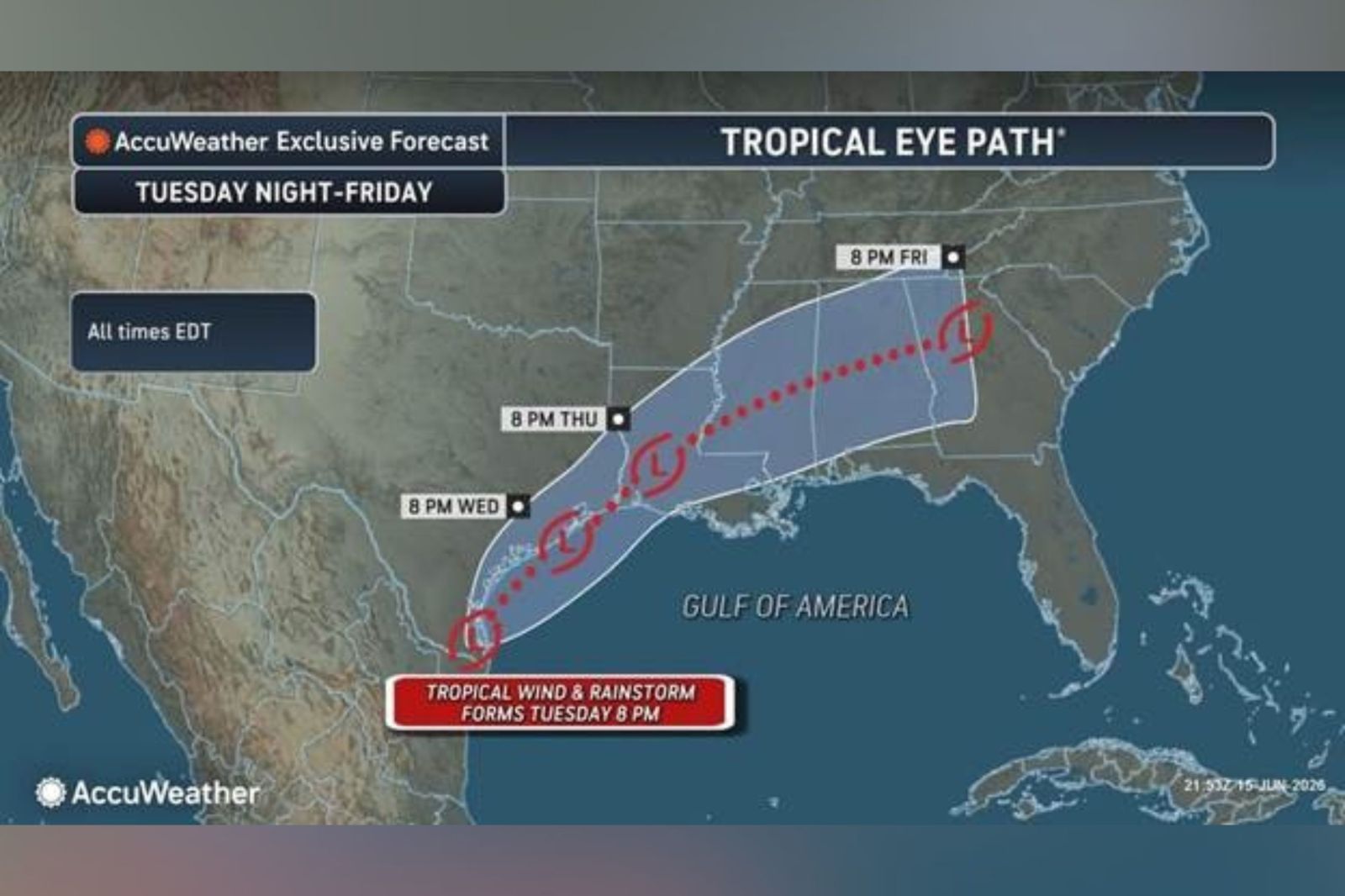
Millions in the Gulf Coast and Lower Mississippi Valley are bracing for potentially life-threatening flash flooding. A weather system near Texas, possibly turning into a tropical storm, is the source of this threat. The disturbance is causing widespread showers and thunderstorms at the Texas-Mexico border. If it strengthens, it could become the first named storm of the season, Arthur.
Rainfall as the Main Threat
Forecasters indicate that the primary hazard is not the wind but the heavy rainfall. Intense rain over several days may overwhelm drainage systems, cause flash flooding, and rapidly raise water levels in rivers. These factors present a significant danger in already saturated areas.
System Near Texas Could Strengthen
The National Hurricane Center (NHC) provided an update stating that a trough of low pressure near the Mexico-Texas border is creating disorganized showers and thunderstorms. The system may move over the northwestern Gulf of America, where conditions could allow for a short-lived tropical storm formation later today or on Wednesday.
“Regardless of tropical cyclone formation, southern and eastern Texas and parts of Louisiana and Mississippi should prepare for intense rainfall, leading to widespread, life-threatening flash, urban, and river flooding,” the NHC advised.
They also warned of gusty winds and potential coastal flooding affecting the northwestern Gulf Coast, with possible tropical storm watches or warnings if the system develops.
Flooding Concerns
AccuWeather alerted Newsweek on Monday about a possible “tropical rainstorm” forming on Tuesday. This term highlights tropical systems that, while possibly unnamed, may pose a significant flooding risk. The situation is worrying due to persistent heavy rains fueled by tropical moisture, resembling historic major flash flooding events.
High-Risk Areas
Forecasts suggest the rain could extend from eastern Mexico through Texas and parts of the Gulf Coast, moving northeastward. Strong storms could bring 2 to 4 inches of rain per hour, heightening the risk of rapidly rising water, especially in urban areas like Houston.
Possibility of Tropical Storm Arthur
As of Tuesday morning, flood watches are active across southern and southeastern Texas, much of Louisiana, and the southern half of Mississippi. The Atlantic hurricane season, which runs from June 1 to November, is predicted to be below normal this year with eight to 14 expected named storms. The NHC remains vigilant, providing updates on the disturbance as the situation evolves.